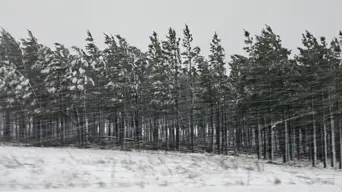
Disruptive snow- and rainfall diminishing, but warnings issued for damaging wind and waves
A Level 6 warning has been issued for damaging waves in the Eastern Cape, and a Level 4 warning for wind and waves in KZN.

Snowfall in KwaZulu-Natal. Picture: Supplied/KZN COGTA
702's John Perlman talks to Richard Le Sueur from Snow Report Southern Africa.
A powerful cold front has brought snow, freezing temperatures, and dangerous conditions to several parts of the country.
In the Eastern Cape, heavy snowfall and deadly collisions forced the closure of the N10 between Cookhouse and Cradock and the N2 outside East London.
Motorists were also warned to drive carefully on the N3.
RELATED: KZN disaster management teams working to 'minimise disruptions' caused by inclement weather
In its latest update, Snow Report says Wednesday's outlook is for less disruptive snow and rain, but the South African Weather Service (SAWS) has issued alerts for damaging wind and waves in some areas. (Click here to see the detailed Thursday forecast)
In light of all the media coverage about the growing incidence of extreme weather events around the world, John Perlman asks Snow Report's Richard Le Sueur if the cold snaps in South Africa have also become more intense over the years.
While the snowfalls we've seen over the past few days have been big, they are not unusual, Le Sueur says.
"This one is pretty big and very low down in some areas of the Eastern Cape - places like Barkly East and up towards the Lesotho border side... and also around Kokstad in KwaZulu-Natal."
Richard Le Sueur, Snow Report Southern Africa
"We have a lot of data that goes back well over 100 years and we're seeing pretty much the same things happening. Some years it's heavy and low down, and some years it's light. We actually see snow pretty much through the year in South Africa, even December/January in some places."
Richard Le Sueur, Snow Report Southern Africa
For more detail, listen to the interview audio at the top of the article